


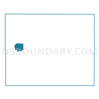
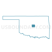
Voting District 439, Oklahoma County, Oklahoma
About
Outline

Summary
| Unique Area Identifier | 654643 |
| Name | Voting District 439 |
| County | Oklahoma County |
| State | Oklahoma |
| Area (square miles) | 6.09 |
| Land Area (square miles) | 2.56 |
| Water Area (square miles) | 3.53 |
| % of Land Area | 42.03 |
| % of Water Area | 57.97 |
| Latitude of the Internal Point | 35.56059420 |
| Longtitude of the Internal Point | -97.57933480 |
Maps

Graphs
Select a template below for downloading or customizing gragh for Voting District 439, Oklahoma County, Oklahoma


Neighbors
Neighoring Voting District (by Name) Neighboring Voting District on the Map
- Voting District 315, Oklahoma County, OK
- Voting District 394, Oklahoma County, OK
- Voting District 395, Oklahoma County, OK
- Voting District 419, Oklahoma County, OK
- Voting District 421, Oklahoma County, OK
- Voting District 423, Oklahoma County, OK
- Voting District 432, Oklahoma County, OK
- Voting District 433, Oklahoma County, OK
- Voting District 440, Oklahoma County, OK
- Voting District 442, Oklahoma County, OK
- Voting District 444, Oklahoma County, OK
- Voting District 562, Oklahoma County, OK
Top 10 Neighboring County Subdivision (by Population) Neighboring County Subdivision on the Map
Top 10 Neighboring Place (by Population) Neighboring Place on the Map
Top 10 Neighboring Unified School District (by Population) Neighboring Unified School District on the Map
Top 10 Neighboring State Legislative District Lower Chamber (by Population) Neighboring State Legislative District Lower Chamber on the Map
- State House District 82, OK (45,418)
- State House District 83, OK (41,419)
- State House District 85, OK (33,785)
Top 10 Neighboring State Legislative District Upper Chamber (by Population) Neighboring State Legislative District Upper Chamber on the Map
- State Senate District 47, OK (89,219)
- State Senate District 40, OK (71,882)
- State Senate District 30, OK (71,145)
Top 10 Neighboring 111th Congressional District (by Population) Neighboring 111th Congressional District on the Map
Top 10 Neighboring Census Tract (by Population) Neighboring Census Tract on the Map
- Census Tract 1085.04, Oklahoma County, OK (6,700)
- Census Tract 1064.03, Oklahoma County, OK (4,927)
- Census Tract 1083.07, Oklahoma County, OK (4,845)
- Census Tract 1085.19, Oklahoma County, OK (3,318)
- Census Tract 1085.06, Oklahoma County, OK (3,224)
- Census Tract 1066.08, Oklahoma County, OK (2,968)
- Census Tract 1064.02, Oklahoma County, OK (2,026)
- Census Tract 1084.03, Oklahoma County, OK (2,001)
- Census Tract 1085.08, Oklahoma County, OK (2,000)
- Census Tract 1084.02, Oklahoma County, OK (1,323)